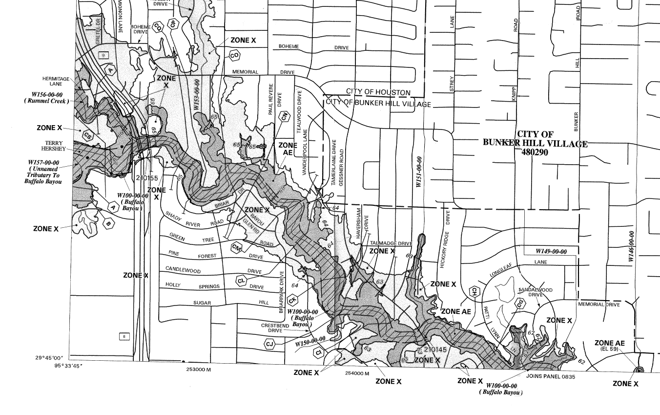
This post shows some of the floodplain maps for an area impacted by Hurricane Harvey in Houston.
An introductory explanation of floodplain maps is given in a previous post:
NFIP Floodplain maps
The maps for any address (or latitude and longitude coordinates) can be found at the website below.
-------------------------------------------------------------------------------------------------------------

--------------------------------------------------------------------------------------------------------------------------
The front panel of the maps will provide information including the map date.
-------------------------------------------------------------------------------------------------------------

--------------------------------------------------------------------------------------------------------------------------
Base flood elevations and cross section lines are shown on the maps. The legend for these items is shown below.
-------------------------------------------------------------------------------------------------------------

--------------------------------------------------------------------------------------------------------------------------
The floodplain maps below show areas on Buffalo Bayou downstream of Addicks and Barker reservoirs. There are several zones shown on this map.
-------------------------------------------------------------------------------------------------------------

An introductory explanation of floodplain maps is given in a previous post:
NFIP Floodplain maps
The maps for any address (or latitude and longitude coordinates) can be found at the website below.
-------------------------------------------------------------------------------------------------------------

--------------------------------------------------------------------------------------------------------------------------
The front panel of the maps will provide information including the map date.
-------------------------------------------------------------------------------------------------------------

--------------------------------------------------------------------------------------------------------------------------
Base flood elevations and cross section lines are shown on the maps. The legend for these items is shown below.
-------------------------------------------------------------------------------------------------------------

--------------------------------------------------------------------------------------------------------------------------
The floodplain maps below show areas on Buffalo Bayou downstream of Addicks and Barker reservoirs. There are several zones shown on this map.
- Zone AE - base floodplain where base flood elevations are provided
- Shaded Zone X - usually the area between the limits of the 100-year and the 500-year floods
- Unshaded Zone X - area outside the 500-year flood
-------------------------------------------------------------------------------------------------------------
-------------------------------------------------------------------------------------------------------------
The next map shows an area downstream of the area shown in the map above. Flows from Buffalo Bayou flow through Houston and into the bays that are connected to the Gulf of Mexico.
-------------------------------------------------------------------------------------------------------------


Comments
Post a Comment