The flooding downstream of Addicks and Barker reservoirs due to Hurricane Harvey can be seen in the Buffalo Bayou gages below these reservoirs.
Three gages are shown in this post. From upstream to downstream, these gages are:


The flow at this location peaked at about 20,000 cfs. It falls slowly due to releases from Addicks and Barker reservoirs.


The flow is falling slowly due to Addicks and Barker releases.
Buffalo Bayou at Houston
This gage rose about 35 feet in about three days. The gage height fell about 13 feet from its peak and recedes slowly due to Addicks and Barker releases.

Three gages are shown in this post. From upstream to downstream, these gages are:
- Buffalo Bayou at W Belt Dr, Houston, TX
- Buffalo Bayou at Piney Point, TX
- Buffalo Bayou at Houston, TX
Buffalo Bayou at W Belt Drive
The figures for the gage, Buffalo Bayou at W Belt Drive are shown below. This gage shows about a 33 foot rise in about two days due to the rainfall from Hurricane Harvey.

The flow at this location peaked at about 20,000 cfs. It falls slowly due to releases from Addicks and Barker reservoirs.

The gage recorded over 30 inches of rainfall in about four days.

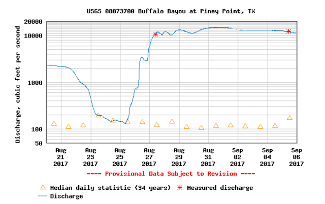
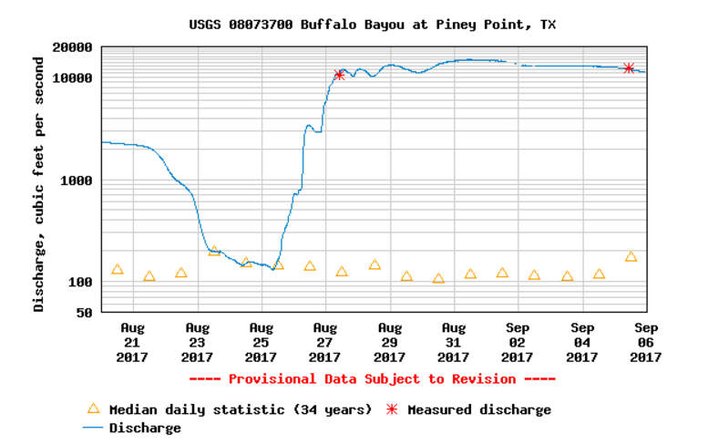
Buffalo Bayou at Piney Point
This gage experienced about a 35 foot rise in about two days.
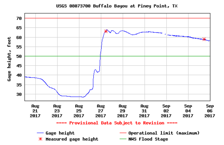
The flow is falling slowly due to Addicks and Barker releases.
Buffalo Bayou at Houston
This gage rose about 35 feet in about three days. The gage height fell about 13 feet from its peak and recedes slowly due to Addicks and Barker releases.

Comments
Post a Comment